| The Menai Strait
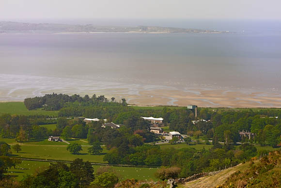
The Menai Strait (Welsh: Afon Menai, the "River Menai") is a narrow stretch of shallow tidal water about 14 miles (23 km) long, which separates the island of Anglesey from the mainland of Wales.
The strait is bridged in two places - the main A5 road is carried over the strait by Thomas Telford's elegant iron suspension bridge, the first of its kind, opened in January 1826, and adjacent to this is Robert Stephenson's 1850 Britannia Tubular Bridge. Originally this carried rail traffic in two wrought-iron rectangular box spans, but after a disastrous fire in 1970, which left only the limestone pillars remaining, it was rebuilt as a steel box girder bridge. When crossing the Britannia Bridge, one might like to look down to the right to observe a house built on a small outcrop of rocks Ynys Gored Goch, right in the middle of the strait.
n places the strait is nearly two miles across but it narrows to little more than 200 metres where it passes underneath the two bridges. The differential tides at the two ends of the strait cause very strong currents to flow in both directions through the strait at different times, creating dangerous conditions. One of the most dangerous areas of the strait is known as the Swellies (or Swillies � Welsh: Pwll Ceris) between the two bridges. Here rocks near the surface cause over-falls and local whirlpools, which can be of considerable danger in themselves and cause small boats to founder on the rocks. This was the site of the loss of the school ship HMS Conway in 1953. Entering the strait at the Caernarfon end is also hazardous because of the frequently shifting sand banks that make up Caernarfon bar. Entering the strait at the south-western end, shipping has to pass Fort Belan, an 18th-century defensive fort built in the times of the American War of Independence.
Tidal effects
The tidal effects observed along the banks of the strait can also be confusing. A rising tide approaches from the south-west causes the water in the strait to flow north-eastwards as the level rises. The tide also flows around Anglesey until, after a few hours, it starts to flow into the strait in a south-easterley direction from Beaumaris. By the time this happens the tidal flow from the Caernarfon end is weakening and the tide continues to rise in height but the direction of tidal flow is reversed. A similar sequence is seen in reverse on a falling tide. This means that slack water between the bridges tends to occur approximately one hour before high tide or low tide.
Theoretically it is possible to ford the strait in the Swellies at low water, spring tides when the depth may fall to less than 0.5 metres. However, at these times a strong current of around 9 Km/h is running making the passage extremely difficult.Elsewhere in the strait the minimum depth is never less than 2 metres.
Ecology
Because the strait has such unusual tidal conditions, coupled with very low wave heights because of its sheltered position, it presents a unique and diverse benthic ecology. The existence of this unique ecology was a major factor in the establishment of the internationally renowned School of Ocean Sciences at Menai Bridge, part of the University of Wales, Bangor as well as its status as a proposed Marine Nature Reserve. The depth of the channel reaches 15m in places, and the current can exceed 7 knots. It's very rich in Sponges.
Places on the Strait Just north of the rail bridge on Anglesey is the famously named Llanfairpwllgwyngyllgogerychwyrndrobwllllantysiliogogogoch. |

